
DNR upgrades outdoor recreation maps for mobile devices
From MnDNR – Navigating Minnesota’s woods and waters with a mobile device is now easier than ever with new digital maps available from the Minnesota Department of Natural Resources.
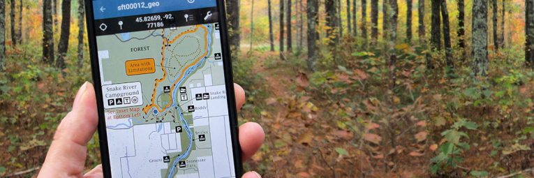
Cartographers in the Parks and Trails Division have recently upgraded nearly all of the maps for Minnesota state parks, state water trails, off-highway vehicle (OHV) trails and public water access sites to geospatial (location-referenced) PDF files (or GeoPDFs for short). State trail and snowmobile trail maps will be available in about a month.
“Our new GeoPDF maps are part of our ongoing efforts to improve the visitor experience,” said Erika Rivers, director of the DNR’s Parks and Trails Division. “Knowing exactly where you are at any given time takes away the worry about getting lost, so you can focus instead on having fun outdoors.”
The GeoPDF maps are best read with Avenza Maps, a GeoPDF reader app, which is available for free from the Google Play Store (for Android devices) or the App Store (for iPhones). Internet access is needed to install the app and map files, but once they are installed, they do not need internet access or cell phone service to function.
“The app relies solely on a device’s built-in GPS receiver to track your movement,” Rivers said. “Your location is represented on the map by a small blue dot, which moves as you move.”
Instructions on how to download the application and map can be found on the DNR website.
For more information, visit the DNR website or contact the DNR Information Center by emailing info.dnr@state.mn.us or by calling 888-646-6367 (8 a.m.-8 p.m. Monday through Friday, 9 a.m.-1 p.m. Saturday).