
That trail was as bumpy as the year 2020.” “Oh, really? I thought is was smooth as butter.”
Discerning an objective rating for a trail condition can be a daunting project—something Parks & Trails Council (P&TC) learned when we first undertook the task for our 2017 State of the Trails Report.
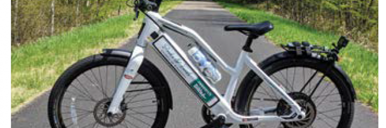
By 2019, with our process refined, and a suped up ResearchBike and robust data analysis to prove it, we released a first-of-its-kind report documenting the condition of all paved state trails in Minnesota. Now, we’ve taken that show on the road, or more accurately on the Saint Cloud area trail system.
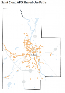
Saint Cloud planners recently developed a Metropolitan Transportation Plan, but in the process they realized they lacked data on an important part of their system: active transportation. Infrastructure such as sidewalks, bicycle lanes, and paved trails needed better anaylsis.
 We responded to their call for data. In May, our research and policy manager, Andrew Oftedal, tuned up the ResearchBike and pedaled every mile of the Saint Cloud area system. He logged everything, from a 0.1 mile neighborhood path to the 40+ stretch of the Lake Wobegon Regional Trail.
The full 52-page report was delievered to the Saint Cloud Area Planning Organization and will inform their future planning, hopefully leading to smart investments in active transportation for the region.
With this ResearchBike, P&TC is filling an information gap that has weighed down trail development. We are now in discussions with other trail managers to bring our ResearchBike to other areas of Minnesota.
For anyone interested in learning more about this project or the potential to partner on a data collection project, contact P&TC’s research and policy manager, Andrew Oftedal at aoftedal@parksandtrails.org.