
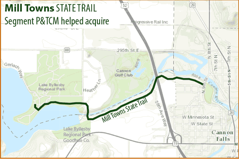
Map of the segment that opened Oct. 2016
Like a puzzle, the newest segment of the Mill Towns State Trail involved many pieces fitting together—just so—to complete the picture. Talks began in 2010 between the DNR, three private landowners, two counties, managers of a dam and a highway. This year, with the commitment of trail proponents, the pieces came together to make a great addition to the state trail system.
Parks & Trails Council became one piece of the puzzle starting in 2011 when a key land acquisition along the route was about to be lost. “Our land program proves its mettle in situations like these when we can step up to ensure such an excellent trail project doesn’t fall apart,” says Brett Feldman, P&TC’s executive director.
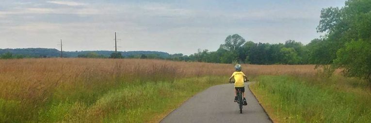
The official grand opening, for this roughly two mile segment, is expected next spring. But already people are biking, walking and fishing along the new corridor. A key feature drawing a lot of attention is the bridge over the Cannon River near Byllesby Dam. On either side lay regional parks, one managed by Goodhue County the other by Dakota County but both named Lake Byllesby Regional Park. The bridge creates the first direct connection between these two parks.
Starting at the Dakota County park beach, trail users can now bike along Lake Byllesby (a dammed section of the Cannon River), wind down to the bridge, descend a gentle grade through prairie and along the river bluff, safely pass under Hwy 52 and end at Hannah’s Bend Park in Cannon Falls. The city is planning to build a trail connection from here to the nearby Cannon Valley Trail.
Steve Hennessy, DNR trail planner, said the trail construction involved some challenges, but succeeded in the end because of the “partnership from Parks & Trails Council, Dakota County, Goodhue County, city of Cannon Falls and the DNR, who all really worked together to make these pieces fall into place.”
The project had a lot going for it with half of the land being publicly owned. The remaining land was owned by three private landowners, which seemed like a manageable number—until all three declined the original offer to buy their land.
That’s when P&TCM stepped in to successfully negotiate a purchase from one owner, where 39 acres (roughly half the land acquired) is being used for the trail. The remaining land was sold to a different owner.
The 39 acres, located near the Goodhue County Park, provided the necessary space to create a gentle slope down through the river blufflands. The land had previously been farmed, and the DNR has plans to restore it to oak savanna.
Funding for this segment of trail came from a variety of sources, including Legacy Funds, Federal grants and state bonds.
The Mill Towns State Trail was originally authorized by the Minnesota Legislature in 2000. When complete, the trail will follow the Cannon River for 25 miles from Faribault to Cannon Falls. The trail will also provide the connection between the Sakatah Singing Hills State Trail and the Cannon Valley Regional Trail.
In addition to this newly opened segment, progress has been made at the other end of the Mill Towns State Trail in Faribault, Minn. The DNR recently built two highway underpasses in the city and Hennessy expects that trail segment, which connects to the Sakatah Singing Hills State Trail to be completed in 2018.
Earlier this summer the DNR acquired six miles of former railroad property for the trail between Faribault and Dundas. Hennessy says the DNR has control over nine miles and now they are working on connecting those pieces. Finally P&TC has been helping to coordinate a necessary re-route of the trail in Northfield.